 |
|
|
|
|
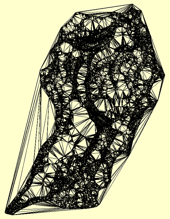
| Map Gallery Slide Show | Image 10 of 75 | San Slavador Island TIN |
 |
||
| Triangulated Irregular Network (TIN)
of the Island of San Salvador in the Bahamas. The model was created using ArcView 3.3 and the Image Analysis Extension. A topographic map from the United Kingdom was scanned in pieces and "cleaned up" in Adobe Photoshop. The image was loaded into ArcView using Image Anlysis and the contours were hand digitized using ArcView. The polyline data and verticies were converted to points using another extension. The points that now had a Z (elevation) value was used to create a Triangulated Irregular Network and a Digital Elevation Model (DEM). This was done using both ArcView and Global Mapper. San Salvador Island is where Christopher Columbus made his first landfall in " The New World" in 1492. It is an incredible place to visit. |
||
|
CLICK HERE TO DOWNLOAD |
||
| < back | up ^ | next > |