 |
|
|
|
|
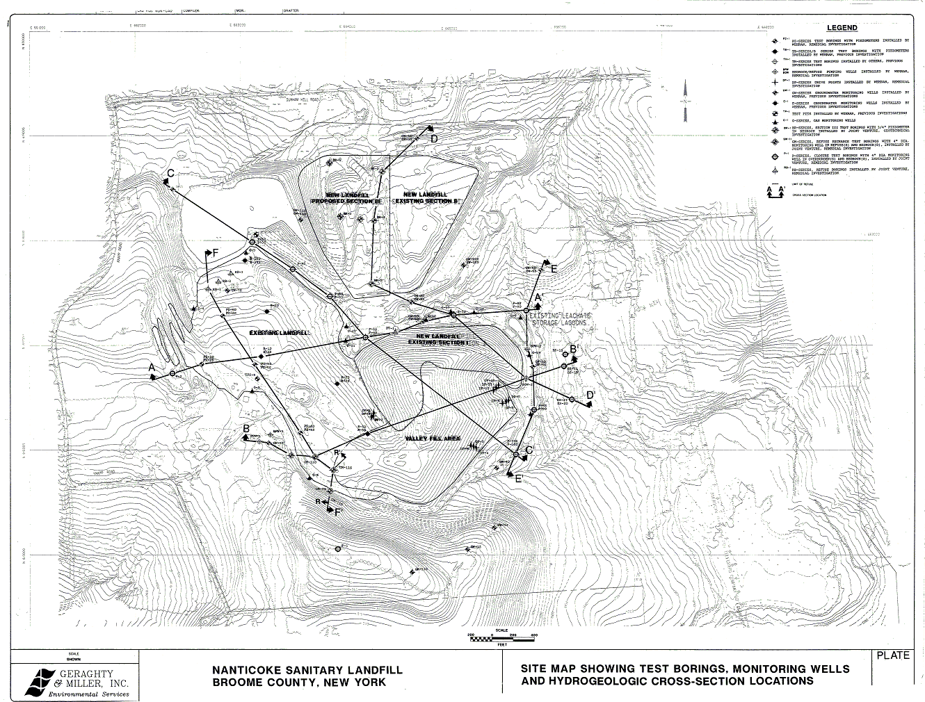
| Map Gallery Slide Show | Image 16 of 75 | Nanticoke Sanitary Landfill |
 |
||
| The Nanticoke Sanitary Landfill in
Broome County, New York This is a site map created using Autodesk AutoCAD release 13 and Softdesk CAD Overlay ESP 7.2 The Nanticoke Landfill is a site in New York State just north of Bignhamton, New York. The landfill was undergoing environmental monitoring and groundwater remediation. The map was created to show the location of groundwater monitoring wells, soil sampling locations and hydrogeologic sections. The original site survey data was scanned using a wide-format grayscale scanner. The scan was saved in Tagged Image File Format (TIFF). The scan was then imported "pasted" into AutoCAD using CAD Overlay ESP. ESP stands for "Edit, Save, Plot". It was then hand digitized and saved in CAD vector format. The image provided here is a scan of the final paper map. |
||
| CLICK HERE TO DOWNLOAD | ||
| < back | up ^ | next > |