 |
|
|
|
|
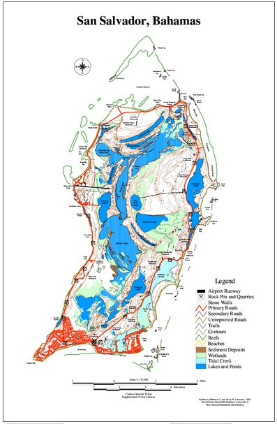
| Map Gallery Slide Show | Image 13 of 75 | San Salvador Island ArcView Map |
 |
||
| San Salvador Island, Bahamas -
ArcView GIS
Map This is a map of San Salvador Island, Bahamas. It was created using ArcView 3.3 and the Image Analysis Extension from scanned maps of San Salvador obtained from the Great Briton Geological Survey. A topographic map from the United Kingdom was scanned in pieces and "cleaned up" in Adobe Photoshop. The image was loaded into ArcView using Image Anlysis and the point, line and polygon themes were hand digitized using ArcView. San Salvador Island is where Christopher Columbus made his first landfall in " The New World" in 1492. It is an incredible place to visit. |
||
| CLICK HERE TO DOWNLOAD | ||
| < back | up ^ | next > |