 |
|
|
|
|
| Map Gallery Slide Show | Image 37 of 75 | Downtown Norfolk Hazard Analysis |
 |
||
| Downtown Norfolk Hazard Analysis | ||
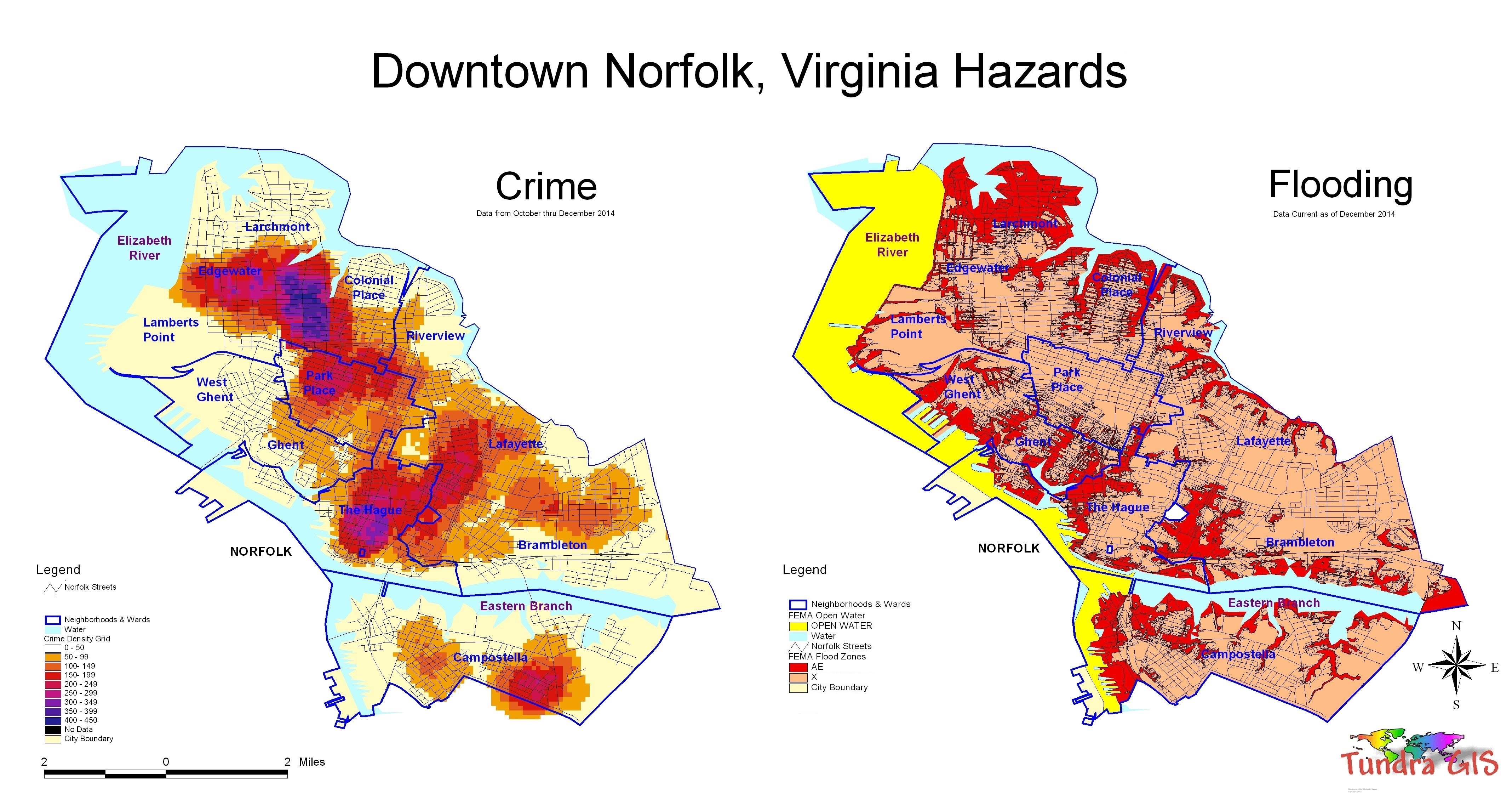
This is a map using data downloaded from the Norfolk Police Department to identify crime hot spots, types of crime as well as other trends and patterns. The analysis was done using Spatial Analyst. This map clearly shows that the Park Place neighborhood has the highest incidences of crime in the city as well as downtown Norfolk. This also is a map using data downloaded from the FEMA identify flood prone areas along with other flood trends and patterns. This map clearly show that the City of Norfolk is particularly prone to flooding especially along the Lafayette and Elizabeth Rivers. |
||
|
|
||
| < back | up ^ | next > |