 |
|
|
|
|
| Map Gallery Slide Show | Image 38 of 75 | Norfolk Crime and Demographics |
 |
||
| Norfolk, Virginia Crime and Demographics Analysis - Fouth Quarter 2014 | ||
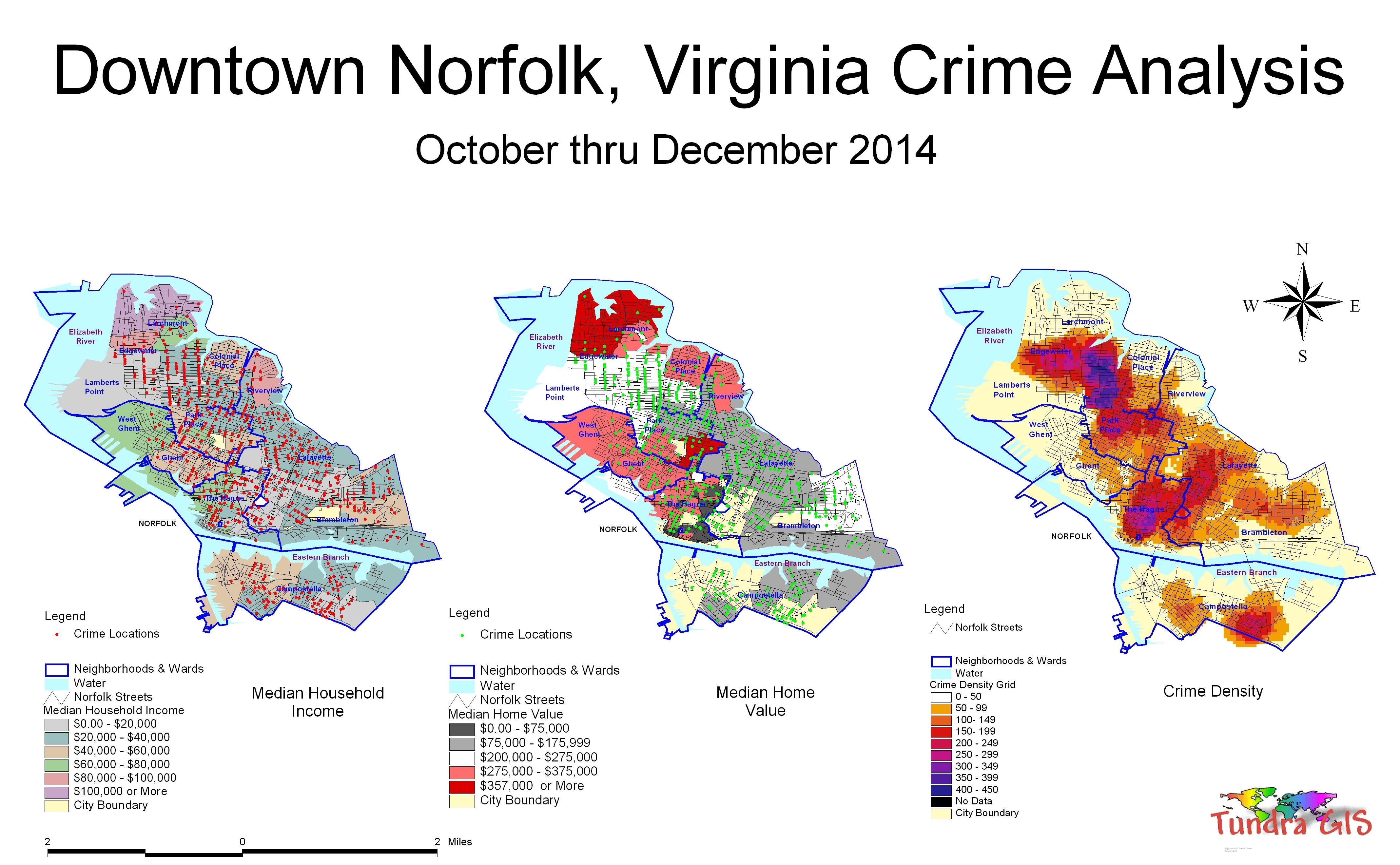
This is a map using data downloaded from the Norfolk Police Department to identify crime hot spots, types of crime as well as other trends and patterns. The analysis was done using Spatial Analyst. This map clearly shows that the Park Place neighborhood has the highest incidences of crime in the city as well as downtown Norfolk. Using GIS, crime analysts can overlay other datasets such as census demographics, locations of pawn shops, schools, etc., to better understand the underlying causes of crime and help law enforcement administrators to devise strategies to deal with the problem. GIS is also useful for law enforcement operations, such as allocating police officers and dispatching to emergencies. |
||
|
|
||
| < back | up ^ | next > |