 |
|
|
|
|
| Map Gallery Slide Show | Image 41 of 75 | CA Groundwater and Drought |
  |
||
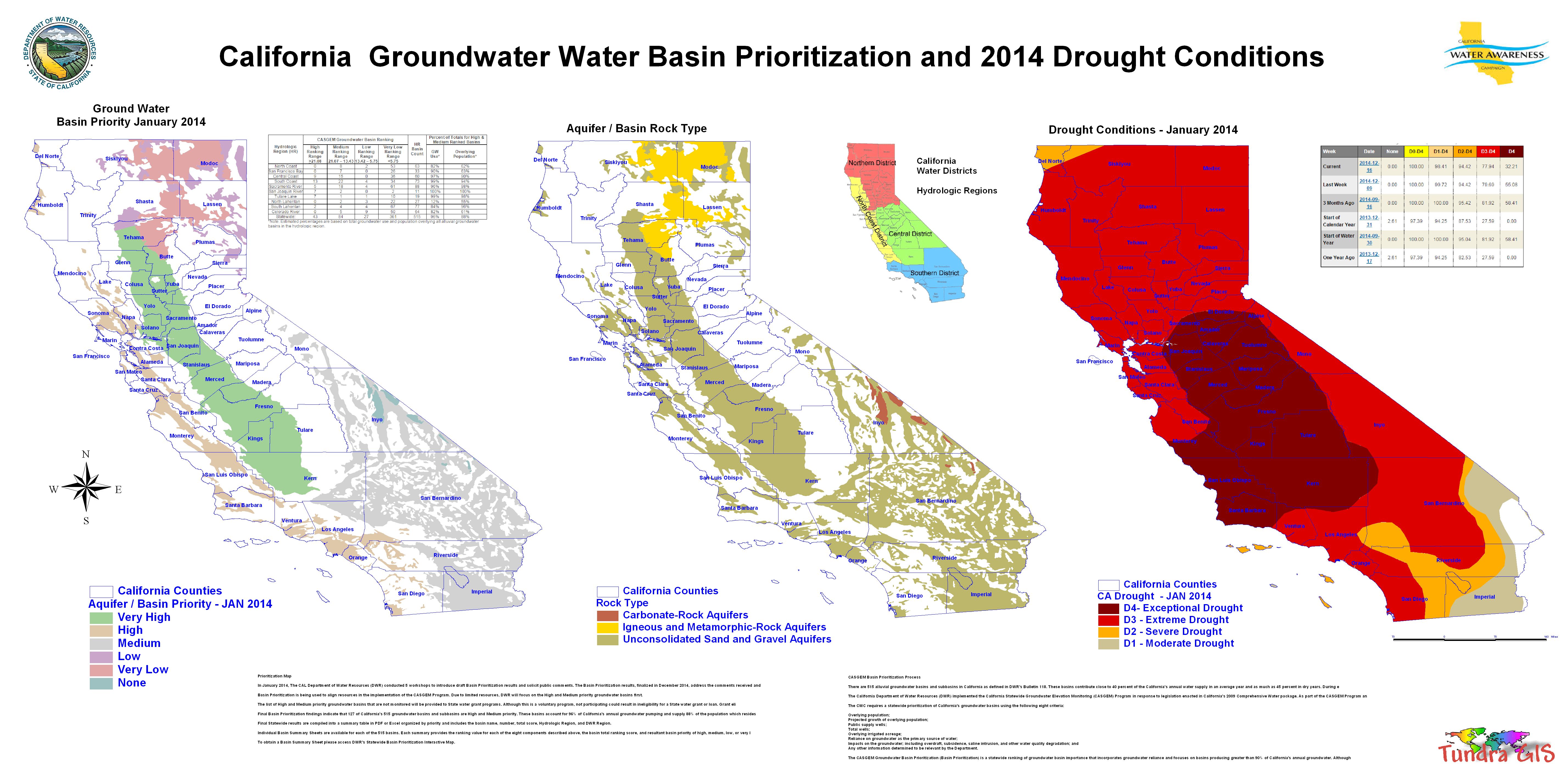
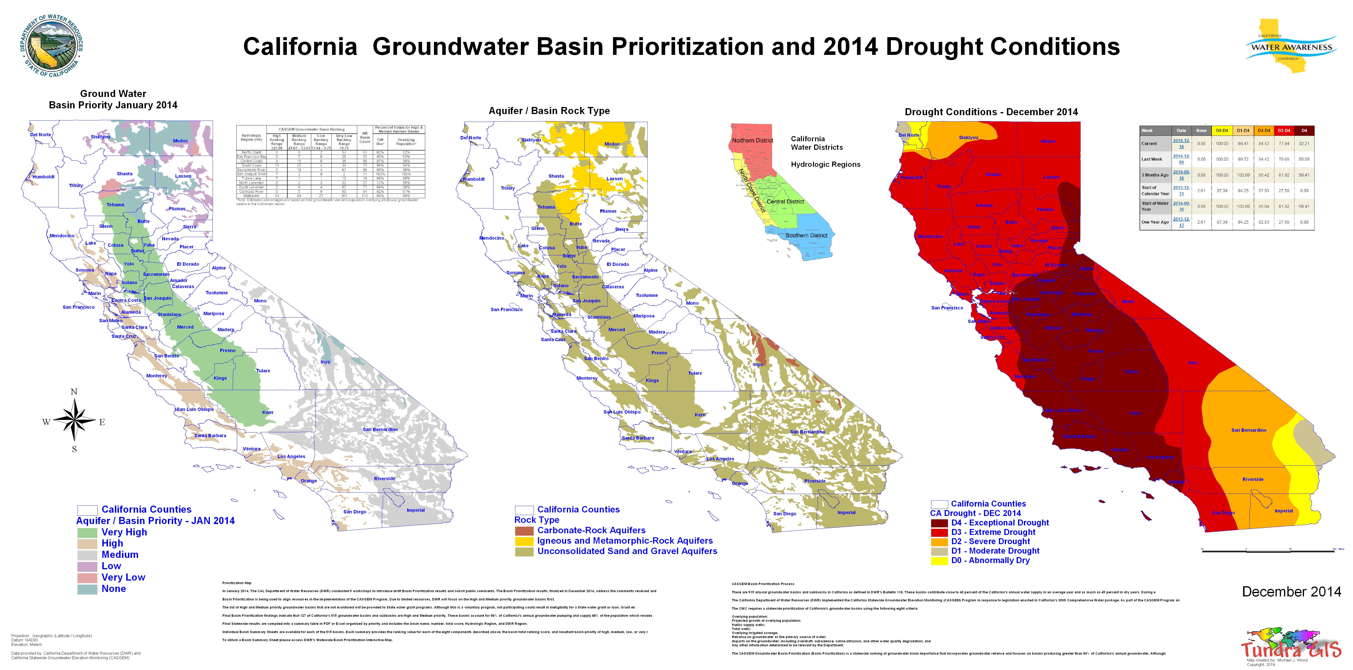
| CA Groundwater Basin Prioritization
- Groundwater Basins, Rock Type and Drought Conditions January 2014 thru December 2014 |
||
Ten years of drought are taking a heavy toll on California's groundwater supplies. Officials for the state's Department of Water Resources reportedTuesday that hundreds of new wells dug this year have contributed to drawing down water to historically low levels, causing some land to sink. The report comes as Gov. Jerry Brown initiated new laws to start managing the state's underground water. Mark Cowin, director of the water resources department, says that without careful groundwater management, California risks losing a water source that sustains cities and farms, especially during drought. "If we fail to manage our groundwater basins sustainably, we risk losing the water supply savings account that can help cities, farms, and businesses survive drought with minimal disruption," Cowin said in a statement. "The Sustainable Groundwater Management Act will help us head off problems such as subsidence and overdraft, which may damage aquifers permanently, and allow local agencies to establish groundwater pumping levels that yield reliable supplies for generations to come." Groundwater basins are the state's largest reservoir collectively and are 10 times the size of all surface reservoirs combined. In part, more than 80 percent of Californian rely on groundwater for drinking water, DWR said. The report says Fresno and Tulare counties have seen the most new wells dug with more than 350 each. Merced County saw more than 200 new water supply wells; and Butte, Kern, Kings, Shasta and Stanislaus counties saw more than 100 wells. The report also said 34 of the 127 high- and medium- priority basins and sub basins are partially or completely not monitored under the Statewide Groundwater Elevation Monitoring Program. In years of normal rain and snowfall, groundwater accounts for 40 percent of supplies for farmers and communities, and the report says that in times of drought, that increases to 60 percent. That increased pumping is causing problems. The San Joaquin River Basin is among those identified as having notable decreases in groundwater levels. Maps included in the report show the San Joaquin Valley covered with red dots, indicating water levels have dropped by more than 10 feet since 2010. In some parts of Merced County, the report shows water levels plunged nearly 50 feet during the past year. Excessive groundwater pumping, the report says, also is causing ground levels to drop, a phenomenon called land subsidence. That, too, is apparent in Merced, according to the maps. |
||
| CLICK HERE TO DOWNLOAD | ||
| < back | up ^ | next > |