 |
|
|
|
|
| Map Gallery Slide Show | Image 42 of 75 | California Geology Map |
 |
||
| California Geology Map | ||
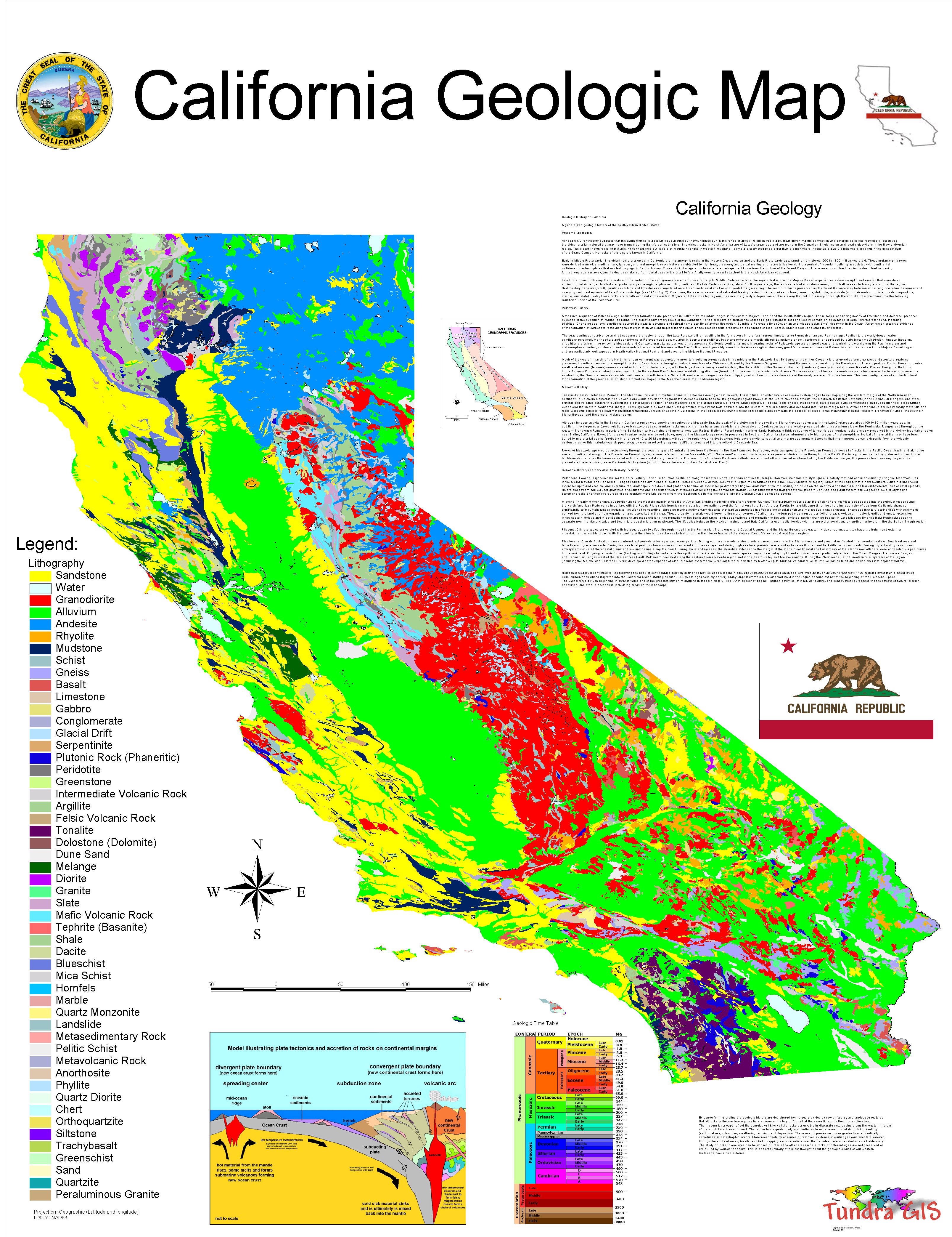
The geologic map of California is a special-purpose map made to show geological features. Rock units or geologic strata are shown by colors or symbols to indicate where they are exposed at the surface. Structural features such as faults and shear zones are also shown. Since the first national geological map, in 1809, there have been numerous maps which included the geology of California. The first California specific geologic map was created in 1891. The most recent state-produced geologic map of California, by the California Department of Natural Resources is 1:750,000 scale, and was created in 2000 by the department's California Geological Survey (CGS). |
||
|
This map was
created for use in other projects as well as demonstrate GIS and
graphics capability. What is a Geologic Map? CLICK HERE TO DOWNLOAD |
||
| < back | up ^ | next > |