 |
|
|
|
|
| 3D Graphics Slide Show | Image 50 of 75 | Saratoga Surficial Geology |
 |
||
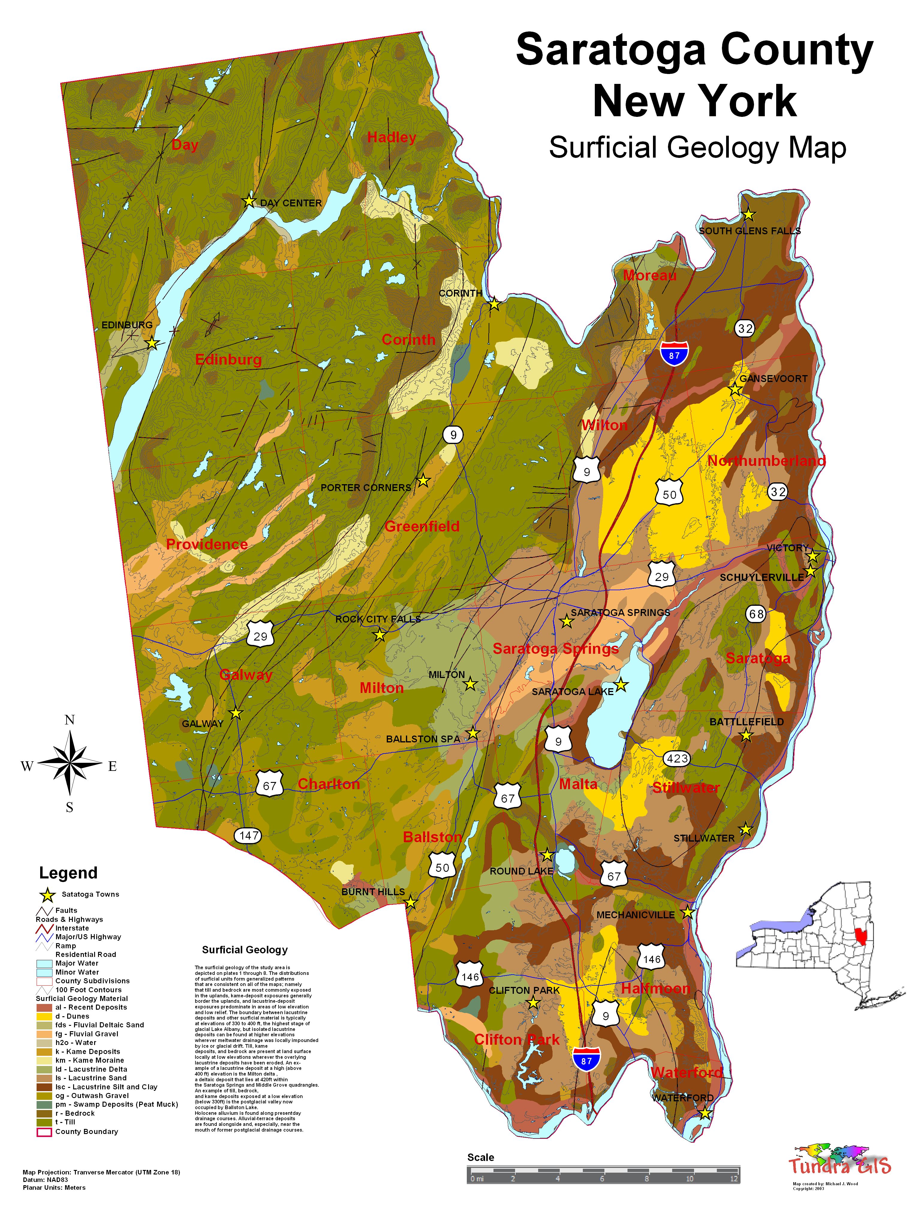
| Saratoga County New York Surficial Geology Surficial The surficial geology of the study area is depicted on plates 1 through 8. The distributions of surficial units form generalized patterns that are consistent on all of the maps; namely that till and bedrock are most commonly exposed in the uplands, kame-deposit exposures generally border the uplands, and lacustrine-deposit exposures predominate in areas of low elevation and low relief. The boundary between lacustrine deposits and other surficial material is typically at elevations of 330 to 400 ft, the highest stage of glacial Lake Albany, but isolated lacustrine deposits can be found at higher elevations wherever meltwater drainage was locally impounded by ice or glacial drift. Till, kame deposits, and bedrock are present at land surface locally at low elevations wherever the overlying lacustrine deposits have been eroded. An example of a lacustrine deposit at a high (above 400 ft) elevation is the Milton delta (Stoller, 1916), a deltaic deposit that lies at 420ft within the Saratoga Springs and Middle Grove quadrangles (pls. 3 and 4). An example of till, bedrock, and kame deposits exposed at a low elevation (below 330ft) is the postglacial valley now occupied by Ballston Lake (pl. 5). Holocene alluvium is found along presentday drainage courses. Alluvial-terrace deposits are found alongside and, especially, near the mouth of former postglacial drainage courses. WHAT IS A GEOLOGIC MAP? CLICK HERE TO DOWNLOAD |
||
| < back | up ^ | next > |